
Norwalk Ohio has unveiled their official Historic Route 20 sign designating the special roadway, part of the longest road in the United States. (The first “Historic Route 20” sign was placed in Painesville Ohio in May 2014.) The Norwalk sign is at the intersection of Main and Church streets. Here is a video of the unveiling ceremony provided by News Norwalk.
All Content © usroutetwenty.blogspot.com unless otherwise noted
The US Route 20 Blog homepage can be found at usroutetwenty.blogspot.com
Friday, February 6, 2015
Tuesday, July 1, 2014
US Route 20: The Rocky Mountain Fly Highway (Documentary Trailer)
There’s great fishing along US Route 20 in Northeast Ohio where I live, but there is some fantastic fishing with spectacular scenery out west on US 20. Here’s a trailer for a one-hour documentary covering what one can expect fishing a 500 mile stretch of US20, shot on location in Wyoming, Montana, Idaho and Oregon.
Rocky Mountain Fly Highway from Wide Eye Productions on Vimeo.
All Content © usroutetwenty.blogspot.com unless otherwise noted
The US Route 20 Blog homepage can be found at usroutetwenty.blogspot.com
Rocky Mountain Fly Highway from Wide Eye Productions on Vimeo.
All Content © usroutetwenty.blogspot.com unless otherwise noted
The US Route 20 Blog homepage can be found at usroutetwenty.blogspot.com
Thursday, May 29, 2014
Historic Route 20 Sign Unveiled in Painesville, Ohio
The first “Historic Route 20” sign in the United States was placed outside Rider's Inn in Painesville, Ohio on May 28, 2014. There is a very interesting article in the local newspaper, The News Herald, with information on the effort to bring more attention to the longest road in the United States.
You can read the article here:
The News Herald: Historic Route 20 sign unveiled in Painesville
Update May 30, 2014: As I live very close to this location I took a drive to Rider’s Inn today for a few pictures of the sign, the street, and the Inn. The picture of the Inn is my version of an old style “postcard” look. Click on any image for a larger view.


All Content © usroutetwenty.blogspot.com unless otherwise noted
The US Route 20 Blog homepage can be found at usroutetwenty.blogspot.com
You can read the article here:
The News Herald: Historic Route 20 sign unveiled in Painesville
Update May 30, 2014: As I live very close to this location I took a drive to Rider’s Inn today for a few pictures of the sign, the street, and the Inn. The picture of the Inn is my version of an old style “postcard” look. Click on any image for a larger view.
All photos © Chris A. Zimmer & usroutetwenty.blogspot.com


All Content © usroutetwenty.blogspot.com unless otherwise noted
The US Route 20 Blog homepage can be found at usroutetwenty.blogspot.com
Tuesday, July 16, 2013
US Route 20: Lakewood Ohio
Here are photos of US Route 20 (Detroit Road) street signs in Lakewood Ohio (just west of Cleveland), near the Rocky River Reservation of the Cleveland Metroparks.


All Content © usroutetwenty.blogspot.com unless otherwise noted
The US Route 20 Blog homepage can be found at usroutetwenty.blogspot.com
Friday, June 21, 2013
US Route 20: Mentor Ohio Memorial Day
Here is a photo of US Route 20 (Mentor Avenue) in Mentor Ohio, which is lined in flags for Memorial Day and the summer holidays. Also included is a video of the Memorial Day parade from the same location.

All Content © usroutetwenty.blogspot.com unless otherwise noted
The US Route 20 Blog homepage can be found at usroutetwenty.blogspot.com

All Content © usroutetwenty.blogspot.com unless otherwise noted
The US Route 20 Blog homepage can be found at usroutetwenty.blogspot.com
Thursday, September 6, 2012
US Route 20: Cleveland Ohio at East 9th Street
Here are two photos of US Route 20 (Euclid Avenue) at the corner of East 9th Street in downtown Cleveland Ohio. The first photo is looking west (toward the Terminal Tower). The second photo is looking at the actual intersection of US20 and East 9th Street, with the Cleveland Trust Rotunda on the southeastern corner. (The Ameritrust Tower, designed by Marcel Breuer, sits behind the rotunda).


All Content © usroutetwenty.blogspot.com unless otherwise noted
The US Route 20 Blog homepage can be found at usroutetwenty.blogspot.com


All Content © usroutetwenty.blogspot.com unless otherwise noted
The US Route 20 Blog homepage can be found at usroutetwenty.blogspot.com
Wednesday, August 8, 2012
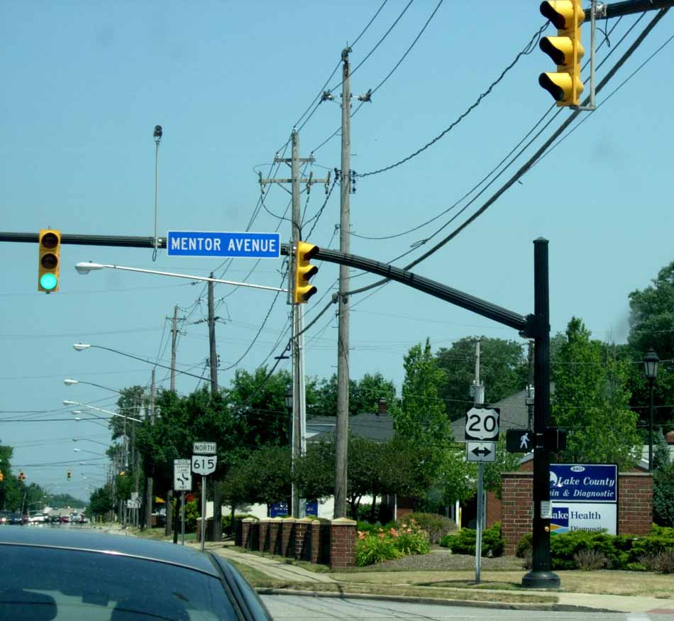
US Route 20: Mentor Ohio
Here are two photos of US Route 20 (Mentor Avenue) in Mentor Ohio. One photo was taken at the intersection on US20 and Rt. 615 (Center Street); the other is taken on Mentor Avenue, heading eastbound.


The US Route 20 Blog homepage can be found at usroutetwenty.blogspot.com

All Content © usroutetwenty.blogspot.com unless otherwise noted
The US Route 20 Blog homepage can be found at usroutetwenty.blogspot.com
Subscribe to:
Posts (Atom)